
India’s Disaster Map – States Most at Risk
What needs attention
- The article topic must be linked to the actual occupancy and hazard
- Prevention and early warning provide more safety margin than last-second intervention
- Equipment is effective only when correctly selected, accessible and maintained
- People need short practised actions and a clear decision to stop and escape
- Children, visitors and people needing assistance require explicit planning
- Records, drills and inspections matter only when defects are corrected
Controls that reduce risk
- Complete a task- and site-specific hazard assessment
- Verify applicable Indian, state and local requirements
- Use competent inspection for installed systems and specialist hazards
- Keep alarms, exits, signs and emergency access usable
- Train intended users and practise evacuation
- Record defects with an owner and completion date
- Review the plan after changes, incidents or near misses
Understand and apply the guidance
🔴 Truth Drop
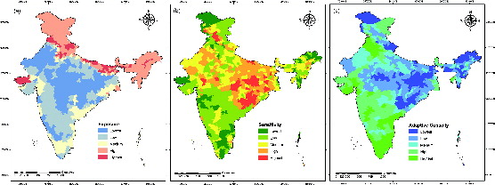
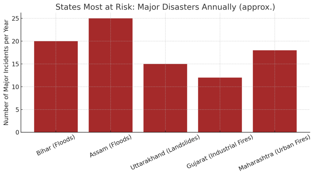
Certain states face yearly disasters: Assam & Bihar (floods), Uttarakhand (landslides), Gujarat (industrial fires), Maharashtra (urban fires).
📖 Why This Matters
Disaster risk in India is uneven. Assam floods displace lakhs every year, Bihar’s embankments collapse, Uttarakhand’s hills slide, Gujarat sees factory fires, and Mumbai faces annual monsoon chaos. Yet most citizens in these zones don’t know their risks, and governments prepare reactively, not proactively.
💥 Myth vs Fact
- Myth: “Disasters strike randomly.”
- Fact: Most disasters strike in predictable zones — the same states suffer year after year.
- Myth: “Only poor areas suffer most.”
- Fact: Urban cities like Mumbai and Surat face billions in annual economic loss too.
📊 Data & Visual
🧰 What You Can Do Today
- Flood States (Assam, Bihar): Keep boats ready, elevate valuables, store dry food.
- Hill States (Uttarakhand): Avoid construction on slopes; know safe landslide shelters.
- Industrial States (Gujarat): Push for factory audits, worker training, safety equipment.
- Metro Cities (Mumbai, Delhi): Demand drainage upgrades, fire NOCs, and drills in societies.
📎 Sources
NDMA Hazard Zonation Maps, State Disaster Management Plans, UNDRR Reports.
📣 Call to Action
“Know your zone. Prepare for your zone. Share this map with your community.”
🔚 Closing Line
“Geography shapes risk — but awareness shapes survival.”
Common unsafe practices
- Relying on equipment without a hazard assessment
- Blocking or compromising escape routes
- Delaying the alarm or emergency call
- Attempting a response beyond training or safe conditions
- Re-entering before authorised clearance
- Treating a checklist as a substitute for competent inspection