
What happened here
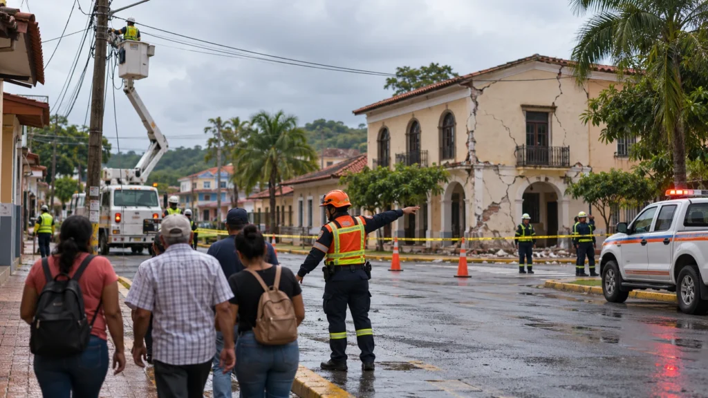
A strong earthquake affected southern and central Panama on 9 October. It led to evacuations and uneven disruption to water systems, roads, buildings and airport operations. The Panama Canal Authority reported normal Canal operations while it inspected facilities.
What happened
At 12:56 p.m. local time on 9 October, a strong earthquake shook southern Panama and was felt far beyond the epicentral area. The U.S. Geological Survey’s reviewed event solution is magnitude 7.7, west-southwest of Pitaloza Arriba. News reports initially carried changing figures; this case study uses the later USGS M7.7 solution and notes that Panama’s Institute of Geosciences reported M7.5.
The later EFE/SINAPROC balance reported at least 27 minor injuries, about 300 evacuations and more than 400 affected buildings. It reported no deaths or missing people at that time. These are early figures, not a final audit.
What was disrupted — and what was not
Reports described damage to homes, schools, health facilities, bridges, road sections and water infrastructure. AP reported that Tocumen International Airport temporarily suspended operations and later reopened. EFE reported water-plant impacts, including an early 20% operating level at the plant serving the capital.
The Panama Canal should not be described as closed or disabled. AP reported that the Panama Canal Authority said operations were continuing normally while specialist teams inspected facilities. An inspection is a safety measure, not proof that operations stopped.
What to do during strong shaking and aftershocks
- If indoors, Drop, Cover and Hold On. Protect your head and neck; do not run toward exits during shaking.
- If outdoors, move to an open area away from buildings, walls, power lines, trees and signs.
- Expect aftershocks. Do not re-enter a visibly damaged building for belongings.
- Follow official evacuation instructions, especially near coasts during any tsunami warning.
- Avoid damaged roads, bridges, utility lines and barriers. Do not drive around closures.
- Use civil-protection and utility updates rather than unverified social-media claims.
Why the numbers may change
Inspectors must reach communities, separate new damage from pre-existing defects and consolidate health reports. “More than 400” affected buildings is not a final demolition or repair count, and 27 injuries is an early reported minimum. This case study does not assign causes to individual failures.
- USGS M7.7 earthquake occurs west-southwest of Pitaloza Arriba
- Evacuations and inspections begin; Tocumen temporarily suspends operations
- AP reports airport reopening and Canal operations continuing while facilities are inspected
- EFE/SINAPROC early balance reports at least 27 minor injuries, about 300 evacuations and more than 400 affected buildings
Why consequences escalated
- USGS final reviewed event magnitude is 7.7
- Later early official reporting described 27 minor injuries, roughly 300 evacuations and more than 400 affected buildings
- Airport operations were temporarily paused and later resumed
- The Canal Authority reported normal Canal operations while inspections continued
Failures and risk multipliers
- Do not call the Panama Canal closed or disabled when reported information says operations continued
- Do not present the early 27-injury figure or 400-building count as final
- Do not combine magnitude with injury or building counts in one comparison chart
- Do not present Panama’s M7.5 local solution and USGS M7.7 solution as a contradiction without identifying the different reporting institutions
Actions that reduce risk
- Drop, Cover and Hold On during shaking
- Move away from damaged facades, power lines, roads and bridges after shaking
- Expect aftershocks and do not re-enter unsafe buildings
- Follow official civil-protection, utility, road, airport and tsunami instructions
- Do not spread unverified casualty or service-outage claims
Leave a comment