
Quick answers
Which Indian states face the highest disaster risk?
Assam and Bihar face frequent floods, Uttarakhand faces landslides, Gujarat sees industrial fires, and Maharashtra, including Mumbai, faces urban fires and monsoon disruption.
How should people in flood-prone states like Assam and Bihar prepare?
Keep boats ready where possible, raise valuables above flood level, store dry food, and follow current state and district warnings and evacuation orders.
What should people in hill states like Uttarakhand do about landslide risk?
Avoid construction on slopes and know where the safe landslide shelters are in the area, following state and district disaster advice.
Why should I know the disaster risk of my own area?
Disasters tend to strike the same zones repeatedly, yet many residents do not know their local risks. Knowing your zone helps you prepare for it and share that awareness with your community.
Every part of India faces some natural hazard, but not the same one. A family in Guwahati worries about the Brahmaputra in July, a family in Puri about cyclones in October, and a family in Dehradun about the hillside above the road. Knowing your own zone is the first step to surviving it.
India’s hazard map in numbers
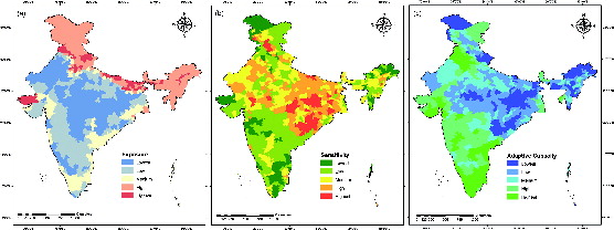
According to the National Institute of Disaster Management (NIDM), 27 of India’s 35 states and union territories (as counted then) are disaster prone:
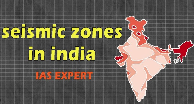
- Earthquakes: almost 58.6% of India’s land is prone to earthquakes of moderate to very high intensity.
- Floods: over 4 crore hectares (40 million hectares, about 12% of the land) is prone to floods and river erosion.
- Cyclones and tsunamis: of India’s 7,516 km coastline, close to 5,700 km is prone to cyclones and tsunamis. On average, five to six tropical cyclones form over the Arabian Sea and the Bay of Bengal each year.
- Drought: 68% of the cultivable area is vulnerable to drought.
- Landslides and avalanches: hilly areas are at risk.
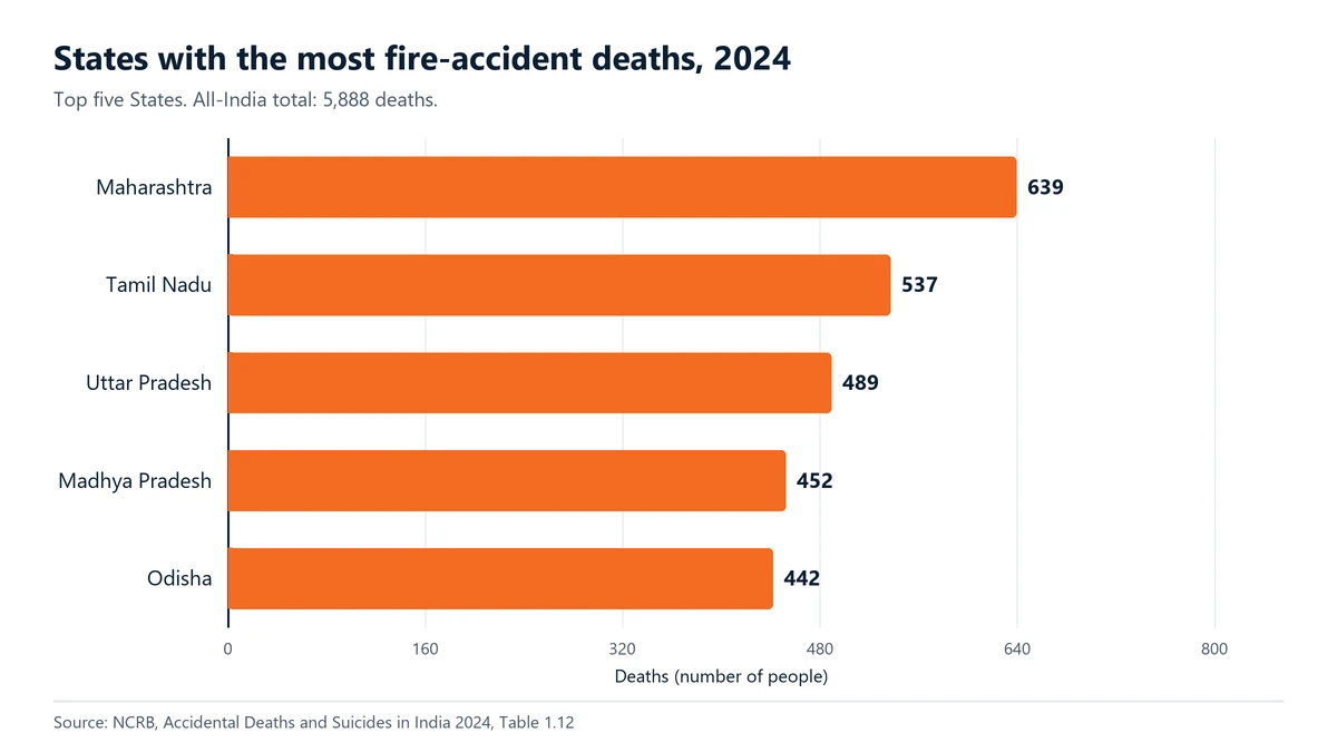
Fire is a hazard everywhere. In 2024, the NCRB recorded the most fire-accident deaths in Maharashtra (639), followed by Tamil Nadu (537) and Uttar Pradesh (489).
What that means region by region
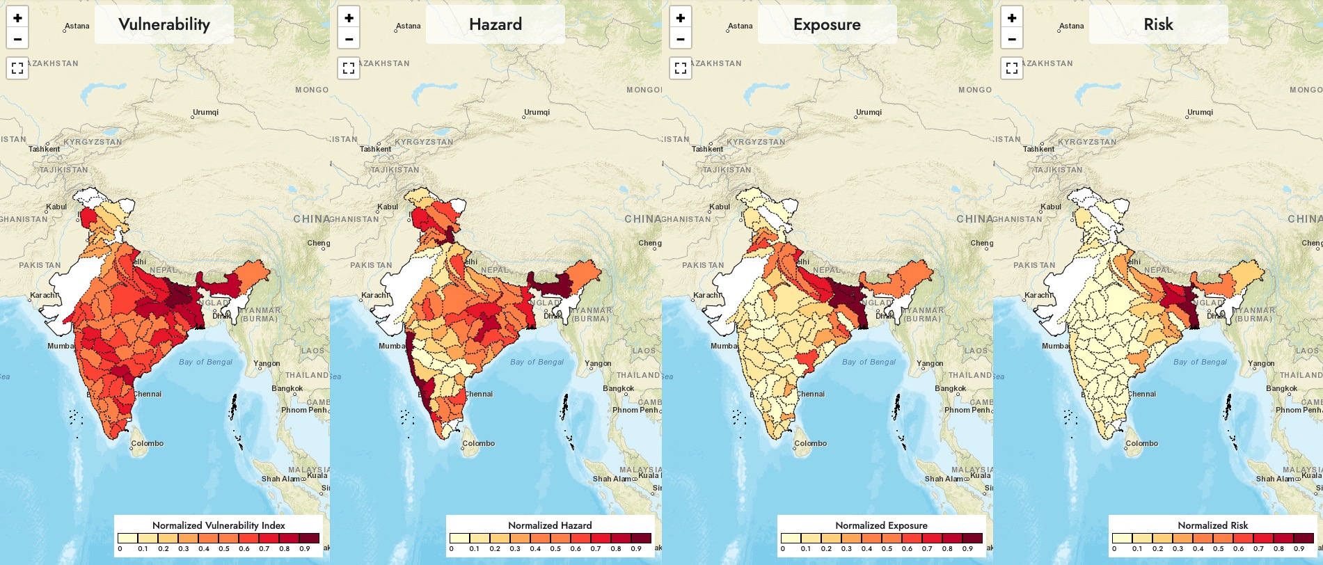
- The Brahmaputra and Ganga plains (Assam, Bihar, eastern UP, West Bengal): river floods and erosion almost every monsoon, often affecting lakhs of people in a bad year.
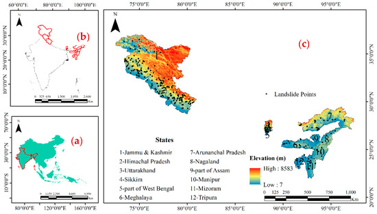
- The Himalayan states (Uttarakhand, Himachal Pradesh, Jammu and Kashmir, the North East): earthquakes, landslides, cloudbursts and flash floods.
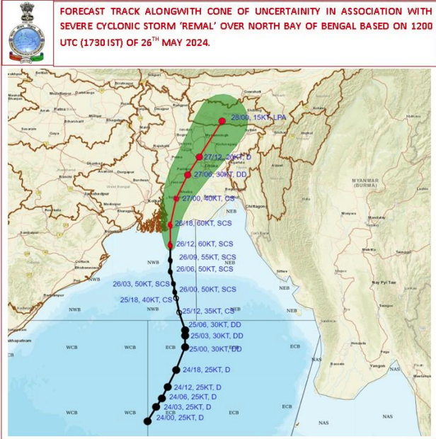
- The east and west coasts (Odisha, Andhra Pradesh, Tamil Nadu, West Bengal, Gujarat): cyclones, storm surge and coastal flooding.
- Dry regions (much of Rajasthan, Gujarat, Maharashtra, Karnataka and Telangana): drought and heat waves.
- Big cities (Mumbai, Delhi, Chennai, Kolkata, Bengaluru): waterlogging and urban floods in the monsoon, and building fires all year.
- Industrial belts: factory fires, explosions and chemical leaks.
Two myths
“Disasters strike at random.” Most do not. The same districts flood, the same coasts face cyclones and the same slopes slide, season after season. That is why preparing for your own zone works.
“Only poor areas suffer.” Poor families are hit hardest and recover slowest, but rich cities suffer too. A single bad monsoon day can shut down Mumbai, and a building fire can happen in the most expensive tower.
What you can do for your zone
- Flood areas: Keep documents, medicines and dry food in a waterproof bag on a high shelf. Know the route to the nearest relief shelter or high ground, and move early when the district warns you.
- Hill areas: Do not build or rent on steep cut slopes or right beside streams. Watch for new cracks, tilting trees or muddy water in streams, and leave the area if you see them.
- Coastal areas: Follow IMD cyclone warnings. Know your nearest cyclone shelter and go when told to evacuate.
- Earthquake zones: Fix heavy cupboards and gas cylinders so they cannot fall, and practise “drop, cover and hold on”.
- Industrial areas: Push for factory safety audits, worker training and proper protective equipment, and know the factory’s alarm and assembly point.
- Cities: Ask your society for fire drills and working fire systems, and push the municipal body to clear drains before the monsoon.
Know your zone, prepare for your zone and share what you learn with your neighbours. Geography decides the risk, but preparation decides who survives. Today, look up whether your district is prone to floods, cyclones, earthquakes or landslides, and save 112 in every family phone.
What needs attention
- Most of India faces at least one major natural hazard
- The same districts, coasts and slopes face the same hazards year after year, so risk is largely predictable
- Floods affect the river plains of the east and north most often
- Himalayan states face earthquakes, landslides and flash floods together
- Fire is a year-round hazard everywhere, with the most recorded deaths in Maharashtra in 2024
- Many residents do not know the main hazard in their own district
Controls that reduce risk
- Find out your district's main hazards from the State Disaster Management Authority
- Prepare a waterproof grab bag with documents, medicines and a torch
- Learn the route to the nearest relief shelter or cyclone shelter
- Secure heavy furniture and gas cylinders in earthquake zones
- Push for factory audits and drills in industrial areas
- Ask your municipal body to clear drains before the monsoon
Common unsafe practices
- Assuming disasters strike at random and cannot be planned for
- Building or renting on unstable slopes or right beside rivers and streams
- Ignoring district flood and cyclone warnings until it is too late
- Keeping documents and medicines where floodwater can reach them
- Leaving heavy furniture and cylinders unsecured in earthquake zones
- Thinking cities are safe from floods and fires
Leave a comment