
Quick answers
How should I prepare before a cyclone hits?
Track official IMD alerts rather than social media, keep an emergency kit with torch, batteries, dry food, medicines and documents, charge phones, store water, and move livestock and valuables to higher ground early.
Is it safe to go outside during cyclone landfall?
No. Never step out or drive during landfall winds, and follow current local warnings and evacuation orders.
What should I do after a cyclone passes?
Avoid fallen power lines, report gas leaks, and check official news before returning home.
Why are cyclone risks increasing on Indian coasts?
Rising sea temperatures, climate change, growing coastal cities and industries, weak embankments and drainage, and the loss of mangroves that act as natural storm barriers.
Between 2019 and 2025, the India Meteorological Department’s regional cyclone centre in New Delhi (IMD RSMC) reported 35 named cyclonic storms over the north Indian Ocean. 25 of them became severe cyclonic storms or stronger. Not all of them reached India, but many hit our east and west coasts.
The damage does not stop at the beach. Cyclones bring floods, power cuts and landslides far inland, and they force lakhs of people from their homes.
Why this matters
Long stretches of both coasts face cyclone risk, and coastal cities like Mumbai, Chennai and Visakhapatnam keep spreading into low-lying, exposed land. Every cyclone leaves two kinds of damage:
- on the land: broken homes, roads, power lines and crops;
- on the people: fear, lost livelihoods, migration and years of debt.
Major cyclones that hit India, 2019 to 2025
| Year | Cyclone | IMD category (peak) | Where it crossed the coast (IMD) | Notes |
|---|---|---|---|---|
| 2019 | Fani | Extremely severe | Odisha (Puri) | 26 April to 4 May 2019 |
| 2019 | Vayu | Very severe | Gujarat coast (did not make landfall) | 10 to 17 June 2019 |
| 2020 | Amphan | Super cyclonic storm | West Bengal and Bangladesh coasts, across the Sundarbans | Weakened to very severe before landfall; 16 to 21 May 2020 |
| 2020 | Nisarga | Severe | Maharashtra, just south of Alibag | 1 to 4 June 2020 |
| 2020 | Nivar | Very severe | Tamil Nadu and Puducherry, close to Puducherry | 22 to 27 November 2020 |
| 2021 | Tauktae | Extremely severe | Saurashtra (Gujarat), about 20 km north-east of Diu | 14 to 19 May 2021 |
| 2021 | Yaas | Very severe | North Odisha coast | 23 to 27 May 2021 |
| 2022 | Asani | Severe | Andhra Pradesh coast, after weakening | 7 to 12 May 2022 |
| 2022 | Mandous | Severe | North Tamil Nadu, near Mamallapuram (as a cyclonic storm) | 6 to 10 December 2022 |
| 2023 | Biparjoy | Extremely severe | Saurashtra and Kutch, close to Jakhau Port (as very severe) | 15 June 2023; IMD: no deaths reported in Gujarat, 7 in Rajasthan from heavy rain |
| 2023 | Michaung | Severe | South Andhra Pradesh, close to Bapatla | 5 December 2023; moved slowly off the north Tamil Nadu coast near Chennai before landfall |
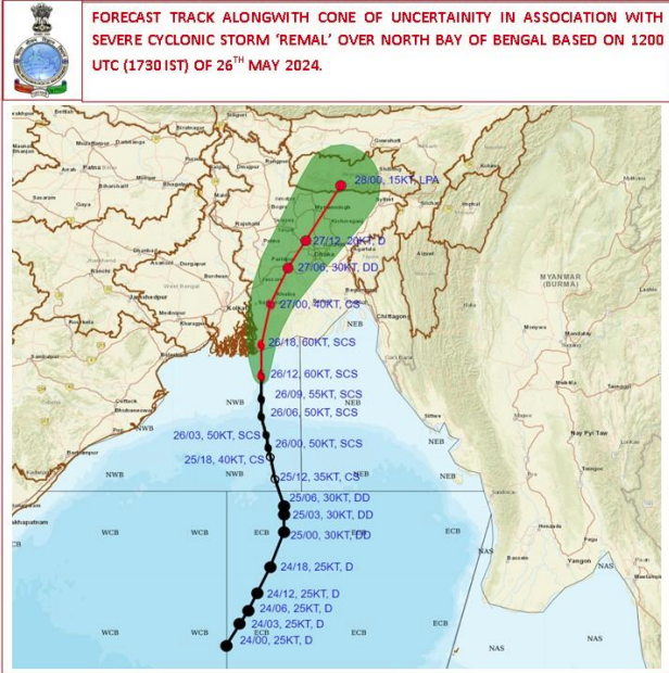
| 2024 | Remal | Severe | Bangladesh and adjoining West Bengal coasts, near Mongla | 26 May 2024; IMD cites media reports of 7 deaths in West Bengal and 30 in Mizoram (landslides) |
| 2024 | Dana | Severe | North Odisha, near Bhitarkanika and Dhamara | Night of 24 to 25 October 2024 |
| 2025 | Montha | Severe | Andhra Pradesh and Yanam, close to Narsapur, south of Kakinada | Night of 28 to 29 October 2025; winds 90 to 100 km/h gusting to 110 |
Source: IMD RSMC New Delhi preliminary and best-track cyclone reports, 2019 to 2025.
The pattern
Of the 35 named storms in IMD’s 2019 to 2025 reports, 22 formed on the Bay of Bengal side (including the Andaman Sea) and 13 over the Arabian Sea. The Bay of Bengal produced more storms, so Odisha, West Bengal, Andhra Pradesh and Tamil Nadu are hit most often. But the west coast is not safe: Tauktae (2021) and Biparjoy (2023) both crossed the Gujarat coast, and Nisarga (2020) hit Maharashtra.
Notice Biparjoy. It was an extremely severe storm, yet IMD reported no deaths in Gujarat. Early warning and timely evacuation work.
Why the risk to people is growing
- Warmer seas can feed stronger storms.
- Changing weather patterns make some storms harder to predict and slower to move, so they dump more rain.
- Crowded coasts. More people, ports and industries now sit in exposed areas.
- Weak coastal protection. Poorly kept embankments and drains that fail in heavy rain.
- Lost mangroves. Mangrove forests act as natural storm barriers, and many have been cut.
What your family should do
Before the cyclone
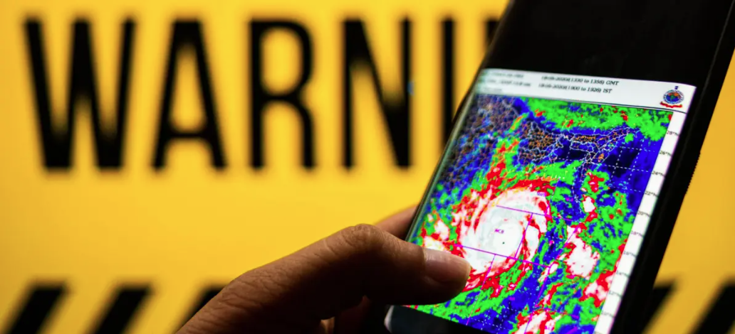
- Follow IMD warnings on TV, radio and official apps. Do not trust forwarded messages on social media.
- Keep an emergency kit: torch, spare batteries, dry food, medicines, documents in a waterproof bag.
- Charge phones and power banks, and store drinking water a day before expected landfall.
- Move livestock and valuables to higher ground early.
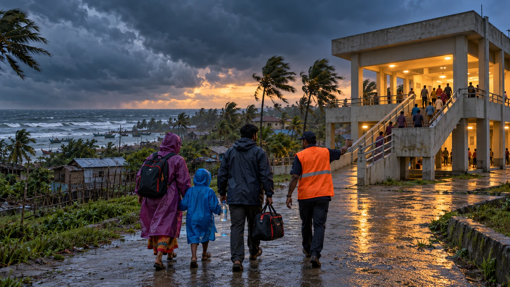
- If the authorities ask you to move to a cyclone shelter, go. Take the elderly, children and medicines with you.
During the cyclone
- Stay indoors, away from windows. Never step out or drive during landfall winds.
- A sudden calm may be the eye of the storm passing. The winds will return from the other side, so stay inside.
After the cyclone
- Keep away from fallen power lines and damaged buildings.
- Report gas leaks, and do not switch on electrical items that got wet.
- Check official news before returning home, and drink only safe water.
What needs to change
- More coastal radar and early warning that reaches every fishing village.
- Stronger embankments and replanted mangrove belts.
- Moving the most exposed settlements to safer land.
- More multipurpose cyclone shelters, following Odisha’s model.
- Trained community volunteers, under NDMA and groups like VFF India.
References
- India Meteorological Department, RSMC New Delhi: preliminary cyclone reports, 2019 to 2025
- India Meteorological Department, RSMC New Delhi: best-track reports (Tracks of Cyclones and Depressions)
- National Disaster Management Authority (NDMA) cyclone guidance
- Odisha State Disaster Management Authority (OSDMA) cyclone shelter model
We cannot stop a cyclone, but we can stop it from killing. If you live on the coast, pack your family’s kit before the season starts, and never ignore an IMD warning because the last one “was not so bad”.
What needs attention
- IMD recorded 35 named storms over the north Indian Ocean from 2019 to 2025, 25 of them severe or stronger
- More storms formed on the Bay of Bengal side, so the east coast is hit most often
- The west coast is also at risk, as Tauktae and Biparjoy showed in Gujarat
- Early warning and evacuation can keep deaths very low, as with Biparjoy
- Damage spreads inland through floods, landslides and power failures
- Lost mangroves and crowded, low-lying coasts raise the risk to people
Controls that reduce risk
- Follow IMD alerts and your district administration's instructions
- Keep an emergency kit with torch, batteries, dry food, medicines and documents
- Know the nearest cyclone shelter and how to get there
- Plan for elderly, children, disabled family members and livestock
- Support mangrove protection and coastal drainage work in your area
Common unsafe practices
- Trusting social media forwards over IMD warnings
- Refusing to move to a shelter when asked
- Stepping out during the calm of the eye
- Leaving it too late to store water and charge phones
- Touching fallen power lines after the storm
- Returning home before officials say it is safe
Leave a comment