
What happened here
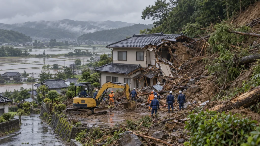
Typhoon Dujuan (Typhoon No. 25) passed close to Tokyo and the Kanto region on 21 September 2026 and dropped record rain. Landslides and floods in Chiba and Kanagawa followed. Japan's Fire and Disaster Management Agency lists 16 deaths, mostly from landslides; the last missing person was found on 3 October.
Quick answers
How many people died in Typhoon Dujuan in Japan?
Japan's Fire and Disaster Management Agency lists 16 deaths for Typhoon No. 25 in its report of 5 October 2026: ten in Chiba, five in Kanagawa and one in Miyazaki. Kyodo News, counting Chiba and Kanagawa only, gives 15.
Is anyone still missing?
No. The last missing person, a man in his 70s caught by a landslide while driving in Nagara, Chiba, was found on 3 October and identified on 4 October 2026, Kyodo reported.
When did Typhoon Dujuan hit Japan?
It passed close to the Izu Islands and the Kanto region around Tokyo on 21 September 2026 and became an extratropical low far east of Japan on the night of 22 September, according to JMA.
Why did so many people die in landslides?
Days of rain had soaked the ground. When the heaviest rain came, slopes failed suddenly. A Kyoto University analysis found the Kamogawa landslide reached a house about 11 seconds after it began.
What should people in India do when a cyclone warning is issued?
Follow IMD and district warnings, move away from the coast, slopes and river banks in daylight, avoid travel, and keep a go-bag ready. Call 112 in an emergency.
What happened
Typhoon Dujuan, Japan’s 25th typhoon of 2026, formed near the Mariana Islands on the night of 16 September. On Monday, 21 September, it passed close to the Izu Islands and the Kanto region around Tokyo as a large and strong typhoon, according to the Japan Meteorological Agency (JMA) summary published by the Cabinet Office. JMA describes it as approaching the coast; some international reports called it a landfall. By 9 p.m. on 22 September it had become an extratropical low far east of Japan.
The wind was not the main killer. The rain was. Over 19 to 21 September, more than 800 mm fell in the Izu Islands and more than 500 mm in parts of Chiba and Shizuoka, according to JMA. Oshima island, south of Tokyo, recorded 832 mm in 48 hours, the highest at that station since its records began in 1991. Tokyo’s Edogawa ward logged a record 282.5 mm in 24 hours, NHK reported via Euronews. Hillsides that were already soaked gave way in Chiba and Kanagawa, and floodwater spread across low farmland around Lake Inba in northern Chiba, where embankments failed at several points.
At 12.40 p.m. on 21 September, JMA issued a Level 5 landslide special warning, the highest level, for Oshima town in Tokyo. It was lowered at 11 p.m. that night. The Fire and Disaster Management Agency (FDMA), quoted by AFP, said more than 16 lakh people in and around the capital were urged to evacuate that Monday; the orders were not mandatory. Some reports put the peak at about 19 lakh. On 22 September, TV Asahi reported that Sakura city in Chiba was still under Level 5 “emergency safety” status.
The people
FDMA’s report of 5 October 2026 lists 16 deaths in the prefectures hit by Typhoon No. 25: ten in Chiba (four in Kamogawa and one each in Mobara, Ichihara, Sodegaura, Inzai, Sammu and Nagara), five in Kanagawa (three in Yokosuka and two in Miura) and one in Nichinan, Miyazaki. The same FDMA report also counts one death in Tamana, Kumamoto, but that was added when the agency folded later rain from Typhoon No. 26 and a weather front into the report, so we have not counted it here. Kyodo News, counting Chiba and Kanagawa only, gives 15.
Most deaths came from landslides that hit houses and roads. TV Asahi reported that a man in his 50s was caught in a landslide in Sodegaura, a woman in her 80s died when slopes collapsed in Kamogawa, and a woman in her 60s died in a landslide in Kanagawa. Jiji Press reported that a man in his 60s in Ichihara and a woman in her 20s in Miura were among the later confirmed deaths. Victims’ names have not been widely published, and we are not publishing them.
The last missing person, a man in his 70s believed to have been caught by a landslide while driving in Nagara town, Chiba, was found under the soil on 3 October. Chiba prefecture confirmed his identity on 4 October, and Kyodo reported that nobody was missing any more. FDMA lists 41 people injured, three of them seriously, in its combined report.
Response and investigation
Chiba set up its disaster headquarters at 12.30 p.m. on 21 September and Kanagawa at 4.30 p.m. The Disaster Relief Act was applied to 24 municipalities in Chiba and one town in Tokyo on 21 September, and later to two cities in Kanagawa, according to the Cabinet Office. Fire brigades from Chiba city, Ichikawa, Matsudo and other areas went to help neighbouring districts, and FDMA sent its own staff and fire research centre experts to Awa, Yokosuka and Chosei. The Self-Defense Forces were clearing fallen trees in Ichihara on 28 September, Jiji reported.
At the peak, about 62,700 households in the Tokyo Electric Power area lost electricity, according to the Cabinet Office. Japan Airlines and All Nippon Airways cancelled 275 flights between them on 21 September (AFP). On 28 September, about 1,600 homes in Chiba had been flooded, about 3,900 homes had no power and around 160 people were in evacuation centres, Jiji reported.
On 25 September, disaster management minister Goshi Hosono said the government expected to designate the typhoon a severe disaster, together with earlier heavy rain in Chiba and Hokuriku, which would raise central support for repairs, Kyodo reported. On 12 October, FNN reported an analysis by Kyoto University landslide expert Professor Takebayashi of the Disaster Prevention Research Institute: the large Kamogawa landslide reached a house about 11 seconds after it started, moving at about 30 km/h on average.
Why this matters for India
Japan has a well-tested warning system, and still 16 people died. Most of them were not hit by wind or sea surge but by soil sliding off soaked slopes, often onto their own homes or onto roads. The expert quoted by FNN made a point every hill district in India should hear: after days of rain, the ground holds water, and a slope can fail even when the rain has eased.
India faces the same mix. Cyclones that cross the Odisha, Andhra or Gujarat coasts often do their worst damage inland, through rain, floods and landslides, days after the eye has passed. NCRB’s Accidental Deaths and Suicides in India 2024 counted 361 flood deaths and 351 landslide deaths in India that year; Kerala alone reported 155 landslide deaths.
Lessons for cyclone and heavy-rain season in India
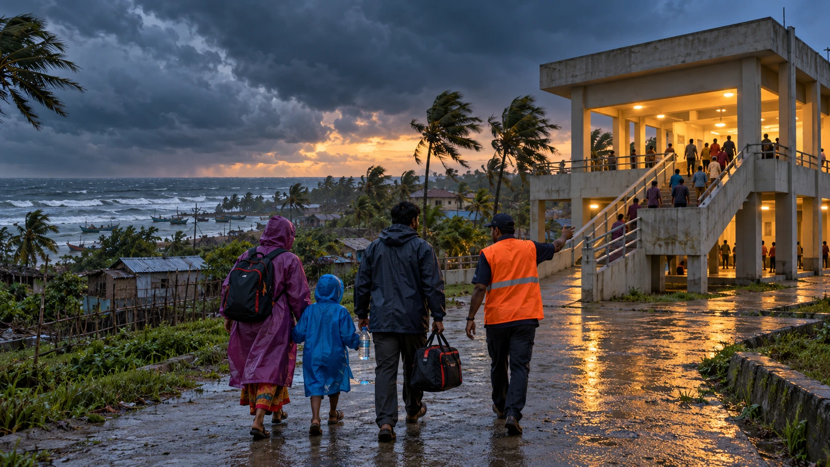
- Act on the warning, not on the sky. When IMD issues an orange or red alert or a cyclone warning for your district, move people from hill slopes, river banks and low-lying lanes in daylight. Do not wait to see water.
- Know if your house sits below a slope. Cracks in the hillside, tilting trees or poles, muddy water from a slope that is usually clear, or rumbling sounds are signs to leave at once.
- The danger does not end when the rain stops. Soaked ground can still slide for a day or two. Go back only when the local administration says it is safe.
- Do not drive into the storm. At least one person in Japan died while driving. Postpone travel, and never drive through flowing water or along a road cut into a wet hillside.
- Keep a charged phone and a torch ready. Power can go for days. Keep a power bank, drinking water, medicines and copies of documents in one bag.
- Save the numbers. In India, call 112 for any emergency, 101 for fire and 108 for an ambulance. In Japan, dial 119 for fire and ambulance and 110 for police.
What is still not known
The formal cabinet decision on the severe-disaster designation, the final housing damage count, the cause of each embankment failure at Lake Inba and the full repair timeline for damaged railway lines had not been published in any source we could find on 17 October 2026. FDMA figures are marked as preliminary and may still change.
- Typhoon No. 25 (Dujuan) forms near the Mariana Islands (JMA)
- FDMA sets up a disaster office and alerts all prefectures as the typhoon heads north
- The typhoon passes close to the Izu Islands and Kanto; Chiba and Kanagawa set up disaster headquarters
- JMA issues a Level 5 landslide special warning for Oshima town; it is lowered at 11 p.m.
- More than 16 lakh people urged to evacuate; 275 flights cancelled; power cut to about 62,700 households at the peak
- Landslides in Kamogawa, Sodegaura, Yokosuka and Miura; FDMA reports 5 dead and 6 missing at 12.30 p.m.
- Lake Inba embankment breaches flood farmland in northern Chiba; the typhoon becomes extratropical at 9 p.m.
- FDMA preliminary count reaches 12 dead and 3 missing
- Minister Goshi Hosono says a severe-disaster designation is expected (Kyodo)
- Jiji reports 14 deaths, including a man in Ichihara and a woman in Miura
- The body of the missing man is found at the Nagara landslide site
- Chiba confirms his identity; nobody remains missing (Kyodo)
- FDMA report: 10 deaths in Chiba, 5 in Kanagawa, 1 in Miyazaki for Typhoon No. 25
- FNN reports a Kyoto University analysis: the Kamogawa landslide reached a house in about 11 seconds
Why consequences escalated
- Most of the 16 deaths were caused by landslides on rain-soaked slopes, not by wind.
- Rain over several days left the ground saturated, so slopes failed quickly once the heaviest rain arrived.
- A Kyoto University analysis found the Kamogawa landslide reached a house about 11 seconds after it began.
- At least one victim was caught by a landslide while driving.
- Embankment failures around Lake Inba kept farmland and homes flooded for days.
- Death counts rose from 2 to 16 over two weeks as searches continued and later deaths were confirmed.
Failures and risk multipliers
- Homes built directly below steep, soaked slopes left families with seconds to escape.
- Travel by road during the heaviest rain exposed drivers to landslides on hillside roads.
- Evacuation orders were advisory, so the decision to leave rested with each household.
Actions that reduce risk
- Families in hill and coastal districts: move away from slopes and river banks as soon as an orange or red alert is issued.
- Local bodies: map homes that sit below unstable slopes and plan their evacuation before the monsoon and cyclone season.
- Drivers: postpone travel during heavy-rain warnings, especially on ghat roads and roads cut into hillsides.
- Residents: keep away from slopes for a day or two after the rain stops.
- Everyone: keep a go-bag with a torch, power bank, water, medicines and document copies.

Leave a comment