How To SurviveLife-Safety Intelligence for India
Language
Automatic translation
City safety guide

Darjeeling Fire and Emergency Safety Guide

Darjeeling is a hill town on steep slopes at about 2,000 metres, with houses, roads and bazaars cut into the hillside. This guide puts the emergency numbers, the official fire stations and the main local risks on one page, and the Namchi guide on this site covers the Sikkim side.

Checked 15 Nov 2026 Incidents update automatically. Emergency card for the fridge or your phone
0incidents covered
0deaths reported
0injured reported
112Emergency 101Fire 112Ambulance (through 112) 100Police
03542-259333 Darjeeling Fire StationOffice line of the station on Hill Cart Road, West Point, as listed by the state fire service

112: Single emergency number for police, fire and ambulance. Works from any phone · 101: The state fire service number. If it does not connect, call 112 · 112: No ambulance number for this district was found on an opened official page, so ask for an ambulance on 112 · 100: Also reachable through 112

Take these numbers with you

Print the Darjeeling emergency card for the fridge or the front door, and cut out the wallet cards. It holds 112, 101, the ambulance and police numbers, and the Darjeeling fire, disaster and civic numbers from this guide. There are blank lines for your family contacts and the nearest hospital.

Download city emergency card (PDF, A4) Print in black and white (PDF, saves ink) Save as phone picture (WebP, made for a phone lock screen)

Checked 15 November 2026. Numbers can change; re-check them before you rely on them.

Latest incidents in Darjeeling

  1. No case studies from this city yet.
Open the full Incident Map See incidents near Darjeeling on the map

Local risks in Darjeeling

Landslides after heavy rain, October 2025

In early October 2025, about 12 hours of torrential rain set off landslides across the Darjeeling hills. Deaths were reported in Mirik and in the Darjeeling subdivision, including Jorebunglow, Sukia Pokhri and the Sadar police station area, and an iron bridge on the Siliguri route was damaged.
The 1968 rainstorm and the road to Siliguri

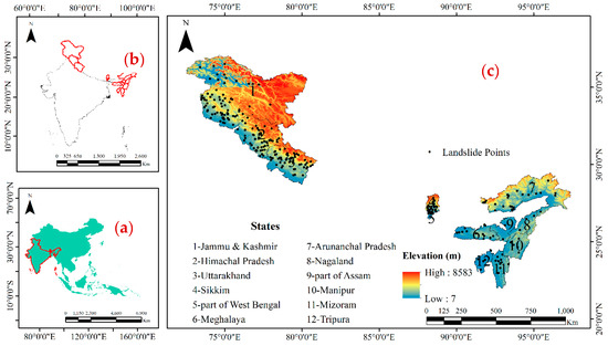
In 1968, a catastrophic rainstorm caused debris flows that cut the 56 km road from Darjeeling to Siliguri in 92 places. Studies in 1990 and 2019 found that landslides remain a serious concern here.

Seismic zone IV and cut slopes

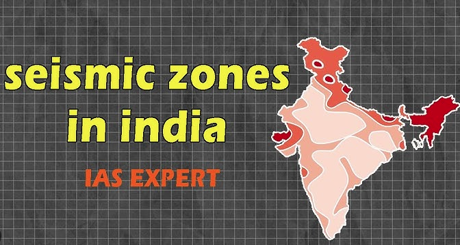
Darjeeling falls in seismic zone IV on the Bureau of Indian Standards scale of I to V. Steep slopes here are undercut to make room for roads and houses, which adds to the danger in both shaking and heavy rain.

Fire in a hill district market, February 2026

On 26 February 2026, a fire destroyed two eateries at Dudhia in the Kurseong subdivision of Darjeeling district. Two engines had to come from the Naxalbari and Matigara fire stations, a reminder that help can be far in this district.

Fire stations in Darjeeling

2 stations. Tap Call to ring the station office.

StationAreaContact
Darjeeling Fire StationDarjeeling · Hill Cart Road, West PointCall03542-259333
Bijanbari Fire StationDarjeeling · Near Bijanbari BDO officeCall03542-260503

Stations are from the West Bengal Fire and Emergency Services list opened on 15 November 2026. Bijanbari is about 8 km away in a straight line, and by hill road it takes much longer. In an emergency, call 112 or 101 first; station lines are office numbers.

Stay safe: quick checklist

Choose another city

Related safety guides

Darjeeling at a glance

Where it is
Darjeeling is a hill town in the Eastern Himalaya, with a Census 2011 area of about 7.4 sq km
Population
About 1.19 lakh in the Census 2011 figure for Darjeeling town
Earthquake zone
Seismic zone IV on the Bureau of Indian Standards scale of I to V
Official fire stations
Two in this guide's circle: Darjeeling and Bijanbari
Emergency system
Dial 112; fire is 101 and police 100

More tools: emergency wallet card, extinguisher chooser